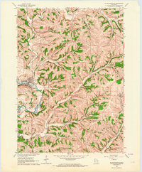
1962 Map of Blanchardville
USGS Topo · Published 1964About this map
Blanchardville sits at a critical junction of water and rail in the early 1960s, where the Pecatonica River meets the Railroad. The surrounding landscape is defined by a dense network of valley branches and hollows, such as Step Valley, McPeace Valley, and Moscow Hollow, which dictated the placement of early settlements and agricultural infrastructure. To the north, the community of Moscow is situated near Blue Mounds Branch, while Postville anchors the eastern edge of the survey area.
Find a feature on this map
37 named features on this map. Tap any name to fly to it.
Don’t see what you’re looking for? This feature index may not catch every label — zoom into the map to look around manually.
Map Details
Editions of this 1962 Blanchardville Map
This is the sole edition of this map. No revisions or reprints were ever made.
Other maps of this area

1920 · Monroe
USGS Topo · 1:62,500

1922 · Monroe
USGS Topo · 1:62,500

1923 · Blanchardville
USGS Topo · 1:62,500

1923 · New Glarus
USGS Topo · 1:62,500

1923 · South Wayne
USGS Topo · 1:62,500

1954 · Rockford
USGS Topo · 1:250,000

1955 · Rockford
USGS Topo · 1:250,000

1958 · Rockford
USGS Topo · 1:250,000
1962 · New Glarus
USGS Topo · 1:62,500
1962 · Monroe NW
USGS Topo · 1:24,000