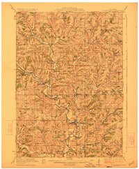
1923 Map of Blanchardville
USGS Topo · Published 1923About this map
Blanchardville sits at the heart of this early 1920s landscape, where the Illinois Central Railroad follows the winding course of the East Branch Pecatonica River. This region at the junction of Iowa, Lafayette, Dane, and Green Counties is defined by a dense network of country schools and churches that speak to a thriving rural society. Every few miles, a family-named or valley-named schoolhouse appears, such as the Jonesdale School, River Forks School, or McKenna School, serving the surrounding farmsteads. To the south, the Yellowstone River and Sawmill Creek carve through the terrain, while the northern reaches transition toward the prominent elevation of the Blue Mounds. The map preserves the exact locations of vanished community hubs like Stewart and Forward, along with significant spiritual centers like the York Churches and the Norwegian Lutheran Church, offering a precise record of Southwest Wisconsin before the consolidation of rural districts.
Find a feature on this map
70 named features on this map. Tap any name to fly to it.
Don’t see what you’re looking for? This feature index may not catch every label — zoom into the map to look around manually.
Map Details
Editions of this 1923 Blanchardville Map
2 editions found
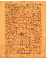
Other maps of this area

1902 · Mineral Point
USGS Topo · 1:125,000

1905 · Richland Center
USGS Topo · 1:125,000

1907 · Cross Plains
USGS Topo · 1:62,500

1909 · Cross Plains
USGS Topo · 1:62,500

1920 · Blue Mounds
USGS Topo · 1:62,500
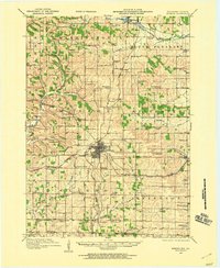
1920 · Monroe
USGS Topo · 1:62,500

1922 · Blue Mounds
USGS Topo · 1:62,500
1922 · Monroe
USGS Topo · 1:62,500

1923 · Blanchardville
USGS Topo · 1:62,500

1923 · New Glarus
USGS Topo · 1:62,500