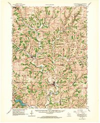
1962 Map of Blanchardville
USGS Topo · Published 1964About this map
Blanchardville sits at a critical junction of the Pecatonica River and the Illinois Central Railroad, serving as a central hub for this portion of the Driftless Area during the early 1960s. The landscape is defined by its dendritic drainage patterns, with numerous valleys like Star Valley and Jeglum Valley carved between high ridges. A significant man-made addition to the natural terrain is Yellowstone Lake, surrounded by the Yellowstone Conservation Area, which transformed the local hydrology of the Yellowstone River.
Find a feature on this map
97 named features on this map. Tap any name to fly to it.
Don’t see what you’re looking for? This feature index may not catch every label — zoom into the map to look around manually.
Map Details
Editions of this 1962 Blanchardville Map
This is the sole edition of this map. No revisions or reprints were ever made.
Other maps of this area

1902 · Mineral Point
USGS Topo · 1:125,000

1905 · Richland Center
USGS Topo · 1:125,000

1907 · Cross Plains
USGS Topo · 1:62,500

1909 · Cross Plains
USGS Topo · 1:62,500

1920 · Blue Mounds
USGS Topo · 1:62,500

1920 · Monroe
USGS Topo · 1:62,500

1922 · Blue Mounds
USGS Topo · 1:62,500

1922 · Monroe
USGS Topo · 1:62,500

1923 · Blanchardville
USGS Topo · 1:62,500

1923 · New Glarus
USGS Topo · 1:62,500