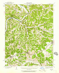
1934 Map of Bland
USGS Topo · Published 1959About this map
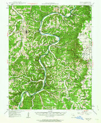
The Gasconade River anchors the northwest corner of this Missouri landscape, winding past Miller Island and steep bluffs like Edwards Bluff and Pinaok Bluff. This 1930s era is defined by the Chicago Rock Island and Pacific railroad, which dictates the growth of settlements like Bland, Belle, and Owensville. Away from the rail line, the terrain breaks into a network of ridges and hollows, including Goerlisch Ridge and Crider Hollow.
Find a feature on this map
108 named features on this map. Tap any name to fly to it.
Don’t see what you’re looking for? This feature index may not catch every label — zoom into the map to look around manually.
Map Details
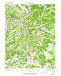
Editions of this 1934 Bland Map
2 editions found
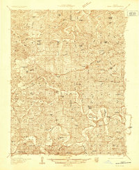
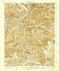
Other maps of this area

1890 · Hermann
USGS Topo · 1:125,000

1890 · Fulton
USGS Topo · 1:125,000

1903 · Sullivan
USGS Topo · 1:125,000

1934 · Linn
USGS Topo · 1:48,000

1934 · Redbird
USGS Topo · 1:62,500
1935 · Gerald
USGS Topo · 1:48,000

1935 · Morrison
USGS Topo · 1:48,000

1936 · Hermann
USGS Topo · 1:48,000
1937 · Bland
USGS Topo · 1:62,500
1937 · Vienna
USGS Topo · 1:62,500