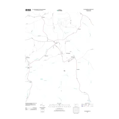
2013 Map of Blandburg
USGS Topo · Published 2013About this map
Glasgow and Blandburg anchor this 2013 topographic study of the Allegheny Front's eastern slopes, where small coal-era settlements follow the narrow creek valleys and winding mountain roads. The map documents the industrial heritage and natural drainage of the region, featuring names like Coke Ovens Rd that hint at the area's history of bituminous coal processing. Steep ridges such as Dakota Ridge Rd divide the landscape, while numerous waterways including Fallentimber Run and Bells Gap Run descend toward the Bellwood Reservoir. Smaller hamlets like Hollentown, Van Ormer, and Frugality appear along the banks of Clearfield Creek, showing the persistent settlement patterns of central Pennsylvania's mountain townships. The topography is defined by narrow gaps and runs that historically dictated the path of local commerce and early rail transport through the Appalachians.
Find a feature on this map
62 named features on this map. Tap any name to fly to it.
Don’t see what you’re looking for? This feature index may not catch every label — zoom into the map to look around manually.
Map Details
Editions of this 2013 Blandburg Map
This is the sole edition of this map. No revisions or reprints were ever made.
Other maps of this area

1902 · Patton
USGS Topo · 1:62,500

1903 · Curwensville
USGS Topo · 1:62,500

1903 · Houtzdale
USGS Topo · 1:62,500

1904 · Patton
USGS Topo · 1:62,500

1905 · Houtzdale
USGS Topo · 1:62,500

1920 · Altoona
USGS Topo · 1:62,500

1922 · Altoona
USGS Topo · 1:62,500

1939 · Curwensville
USGS Topo · 1:62,500

1942 · Curwensville
USGS Topo · 1:62,500

1943 · Punxsutawney
USGS Topo · 1:125,000
Featured Places
- Beccaria Township, PA
- Dean Township, PA
- Clearfield Township, PA
- Bear Loop, Reade Township
- Blandburg, Reade Township