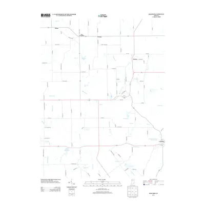
2013 Map of Blocher
USGS Topo · Published 2013About this map
Lexington and the surrounding rural Scott County landscape are defined by a network of small settlements and a complex system of local waterways. This 2013 survey records established communities like Blocher, New Frankfort, Wooster, and Albion, each linked by a grid of farm-to-market roads and county lanes. The area's hydraulic character is visible in the numerous small reservoirs and drainage systems, including the Presbyterian National Missions Lake and Thomas J Miller Lake. These water bodies, alongside Stucker Fork and Kimberlin Cr, illustrate how modern land management and agriculture have integrated with the natural drainage basins. In the western portion of the map, the community of Hopewell sits near Hopewell Drain, showing the historical persistence of local place-names even as the landscape transitions through the early 21st century. The map provides a detailed view of the rural infrastructure, from property-line roads like N Bethlehem Rd to the winding course of White Eye Br.
Find a feature on this map
91 named features on this map. Tap any name to fly to it.
Don’t see what you’re looking for? This feature index may not catch every label — zoom into the map to look around manually.
Map Details
Editions of this 2013 Blocher Map
This is the sole edition of this map. No revisions or reprints were ever made.
Other maps of this area

1947 · Scottsburg
USGS Topo · 1:24,000

1949 · Henryville
USGS Topo · 1:24,000

1956 · Otisco
USGS Topo · 1:24,000

1956 · Volga
USGS Topo · 1:24,000

1956 · Blocher
USGS Topo · 1:24,000

1956 · Kent
USGS Topo · 1:24,000

1956 · Deputy
USGS Topo · 1:24,000
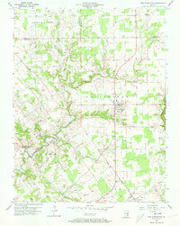
1956 · New Washington
USGS Topo · 1:24,000

1956 · Louisville
USGS Topo · 1:250,000

1959 · Crothersville
USGS Topo · 1:24,000