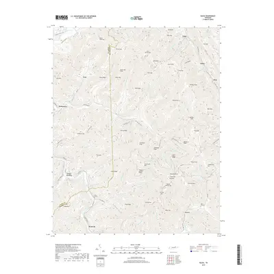
2019 Map of Block
USGS Topo · Published 2019About this map
Smoky Junction and Brookside anchor the southern reaches of this mountainous terrain along the boundary of Scott and Campbell counties. The landscape is defined by the steep ridges of Roach Creek Mtn and Fork Mtn, where numerous gaps like Wolf Gap and Jenney Gap historically dictated movement between isolated valleys. Small settlements such as Turley and Block are situated along the narrow corridors of Straight Fork and Cove Cr, while more remote locales like Dean and Montgomery reflect the area's long-standing connection to local resources and rail-side industry. Genealogists and local historians can locate Nicks Creek Cem and Round Rock Cem, which serve as vital markers of the families who settled these hollows. The modern Cumberland Trail weaves through high points such as Big Bruce Ridge and Grissel Knob, providing a contemporary overlay to the traditional network of forest roads and creek-side paths.
Find a feature on this map
111 named features on this map. Tap any name to fly to it.
Don’t see what you’re looking for? This feature index may not catch every label — zoom into the map to look around manually.
Map Details
Editions of this 2019 Block Map
This is the sole edition of this map. No revisions or reprints were ever made.
Other maps of this area

1893 · Briceville
USGS Topo · 1:125,000

1895 · Briceville
USGS Topo · 1:125,000

1896 · Briceville
USGS Topo · 1:125,000

1936 · Hogbell Gap
USGS Topo · 1:24,000

1936 · Ivydell
USGS Topo · 1:24,000

1936 · Block
USGS Topo · 1:24,000

1936 · Jacksboro
USGS Topo · 1:24,000

1936 · Pioneer
USGS Topo · 1:24,000

1936 · Duncan Flats
USGS Topo · 1:24,000

1936 · La Follette
USGS Topo · 1:48,000