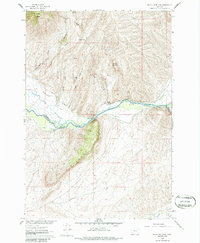
1960 Map of Block Mountain
USGS Topo · Published 1986About this map
The Big Hole River winds through the center of this 1960 survey, marking the political boundary between Madison and Beaverhead counties. This river valley is defined by complex irrigation networks, including the Fred Bryan Ditch and Cocanougher Ditch, which support the agricultural lands along the river's path. The landscape is dominated by the massive Hogback ridge and the namesake Block Mountain to the north. A notable site of early indigenous activity, the Buffalo Jump, sits on the northern bank of the river near where the valley narrows. Higher elevations are characterized by remote infrastructure such as the Buhrer-Garrison Burma Road and scattered mining activity at the Sodak Mine and various unnamed Prospects. Numerous water sources like Chokecherry Spring and Garrison Spring dot the gulches and hollows of the northern hills.
Find a feature on this map
28 named features on this map. Tap any name to fly to it.
Don’t see what you’re looking for? This feature index may not catch every label — zoom into the map to look around manually.
Map Details
Editions of this 1960 Block Mountain Map
4 editions found
Other maps of this area

1893 · Dillon
USGS Topo · 1:250,000

1955 · Dillon
USGS Topo · 1:250,000

1957 · Dillon
USGS Topo · 1:250,000

1958 · Dillon
USGS Topo · 1:250,000

1960 · Glen
USGS Topo · 1:24,000

1960 · Block Mountain
USGS Topo · 1:24,000

1960 · Twin Bridges
USGS Topo · 1:62,500

1961 · Glen SE
USGS Topo · 1:24,000

1961 · Earls Gulch
USGS Topo · 1:24,000

1961 · Nez Perce Hollow
USGS Topo · 1:24,000