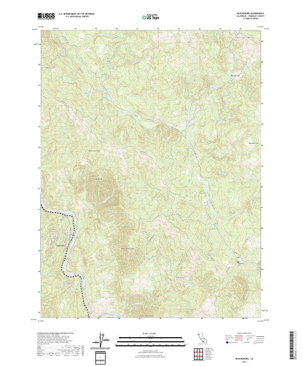
2021 Map of Blocksburg
USGS Topo · Published 2021About this map
Oak Glen and the surrounding Humboldt County wilderness are defined by a series of prominent peaks and deep-cut creek drainages that shape the landscape. Elevated landmarks such as Billy Goat Peak, Great Butte, and Blue Jacket Butte rise above the primary water systems of the Eel River and the meandering Larabee Cr. This remote area, mapped in the modern era, retains a network of winding mountain roads like Alderpoint Rd and Cemetery Rd that connect isolated clearings and flats. In the southeastern corner, the site of the Blocksburg Cem serves as a significant genealogical landmark, while the northern terrain is punctuated by the height of Charles Mtn and the level ground of Boulder Flat. The mapping reflects a region where navigation follows natural ridgelines like Sunset Ridge, documenting the persistent character of these coastal range foothills.
Find a feature on this map
45 named features on this map. Tap any name to fly to it.
Don’t see what you’re looking for? This feature index may not catch every label — zoom into the map to look around manually.
Map Details
Editions of this 2021 Blocksburg Map
This is the sole edition of this map. No revisions or reprints were ever made.
Other maps of this area

1920 · Harris
USGS Topo · 1:62,500

1921 · Dyerville
USGS Topo · 1:62,500

1921 · Briceland
USGS Topo · 1:62,500

1949 · Blocksburg
USGS Topo · 1:62,500

1949 · Alderpoint
USGS Topo · 1:62,500

1949 · Garberville
USGS Topo · 1:62,500

1949 · Weott
USGS Topo · 1:62,500

1951 · Alderpoint
USGS Topo · 1:62,500

1951 · Weott
USGS Topo · 1:62,500

1951 · Garberville
USGS Topo · 1:62,500