
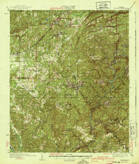
1940 Map of Blocton
USGS Topo · Published 1940About this map
The Cahaba River and Little Cahaba River carve through a landscape defined by Alabama's industrial and rural heritage during the early 1940s. Centered on the coal-mining communities of West Blocton and Blocton, the map reveals a dense network of transit and labor, with the Southern, Louisville And Nashville, and Mobile And Ohio railroads connecting isolated settlements like Belle Ellen and Piper to the broader region.
Find a feature on this map
70 named features on this map. Tap any name to fly to it.
Don’t see what you’re looking for? This feature index may not catch every label — zoom into the map to look around manually.
Map Details
Editions of this 1940 Blocton Map
2 editions found
Other maps of this area

1890 · Bessemer
USGS Topo · 1:125,000

1891 · Clanton
USGS Topo · 1:125,000

1892 · Bessemer
USGS Topo · 1:125,000

1899 · Brookwood
USGS Topo · 1:125,000

1905 · Bessemer Iron District
USGS Topo · 1:62,500

1907 · Bessemer Special
USGS Topo · 1:62,500

1910 · Montevallo
USGS Topo · 1:62,500

1927 · Adger
USGS Topo · 1:48,000

1929 · Searles
USGS Topo · 1:48,000

1931 · Cottondale
USGS Topo · 1:48,000