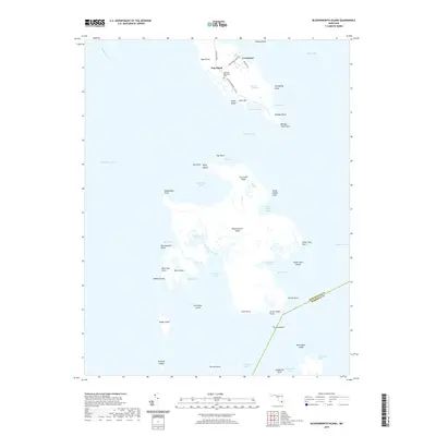
2019 Map of Bloodsworth Island
USGS Topo · Published 2019About this map
Hog Island and its neighbors form a complex chain of marshes and coastal landforms where the Honga River meets the Hooper Strait. The small communities of Crocheron and Bishops Head are the primary settlements, with Crocheron Rd providing the main overland access to the Bethany Methodist Cem. South of the strait, the landscape transitions into the large expanse of Bloodsworth Island, characterized by intricate waterways like Swan Pond Creek and Long Creek. The presence of Phillips Gunning Club Rd on Hog Island highlights the area's tradition as a waterfowl hunting destination. This marshy archipelago includes numerous smaller landmasses such as Billys Island, Pone Island, and Adam Island, illustrating the highly fragmented shoreline of the lower Chesapeake Bay and the Tangier Sound boundary.
Find a feature on this map
62 named features on this map. Tap any name to fly to it.
Don’t see what you’re looking for? This feature index may not catch every label — zoom into the map to look around manually.
Map Details
Editions of this 2019 Bloodsworth Island Map
This is the sole edition of this map. No revisions or reprints were ever made.
Other maps of this area

1898 · St. Marys
USGS Topo · 1:125,000

1903 · Nanticoke
USGS Topo · 1:62,500

1903 · Bloodsworth Island
USGS Topo · 1:62,500

1903 · Deal Island
USGS Topo · 1:62,500

1905 · Crapo
USGS Topo · 1:62,500

1906 · St. Marys
USGS Topo · 1:125,000

1942 · Terrapin Sand Point
USGS Topo · 1:24,000

1942 · Kedges Straits
USGS Topo · 1:24,000

1942 · Bloodsworth Island
USGS Topo · 1:24,000

1942 · Richland Point
USGS Topo · 1:24,000