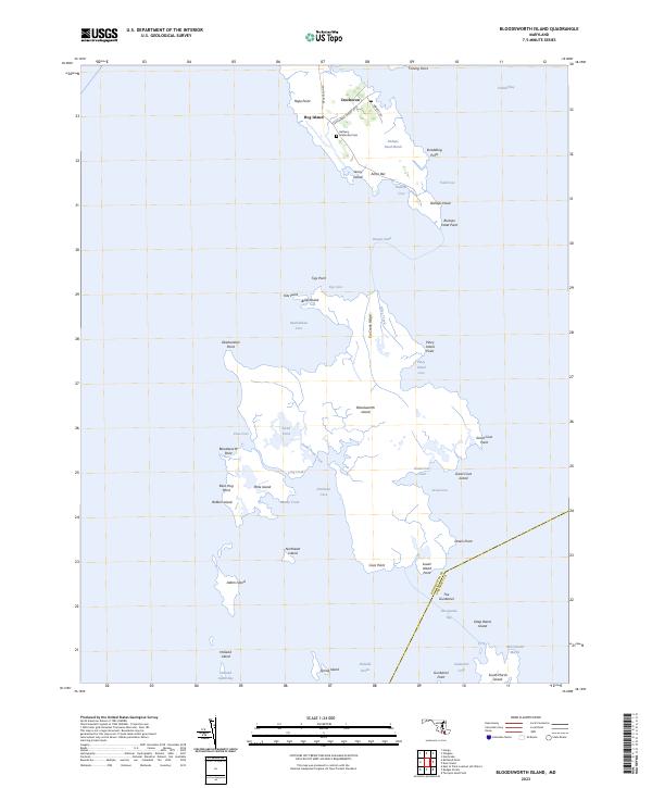
2023 Map of Bloodsworth Island
USGS Topo · Published 2023About this map
The fragmented marshlands and tidal islands of the lower Chesapeake Bay define this coastal landscape, where the boundary between Dorchester and Somerset counties crosses open water. Small settlements like Crocheron and Bishops Head anchor the northern reaches of the map, connected by rural routes such as Crocheron Rd and Crocheron Wharf Rd. The area is characterized by an intricate network of waterways including Hooper Strait, Fishing Bay, and Holland Straits, which separate the mainland from substantial landmasses like Bloodsworth Island.
Find a feature on this map
60 named features on this map. Tap any name to fly to it.
Don’t see what you’re looking for? This feature index may not catch every label — zoom into the map to look around manually.
Map Details
Editions of this 2023 Bloodsworth Island Map
This is the sole edition of this map. No revisions or reprints were ever made.
Other maps of this area

1898 · St. Marys
USGS Topo · 1:125,000

1903 · Nanticoke
USGS Topo · 1:62,500

1903 · Bloodsworth Island
USGS Topo · 1:62,500

1903 · Deal Island
USGS Topo · 1:62,500

1905 · Crapo
USGS Topo · 1:62,500

1906 · St. Marys
USGS Topo · 1:125,000

1942 · Terrapin Sand Point
USGS Topo · 1:24,000

1942 · Kedges Straits
USGS Topo · 1:24,000

1942 · Bloodsworth Island
USGS Topo · 1:24,000

1942 · Richland Point
USGS Topo · 1:24,000