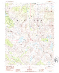
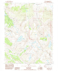
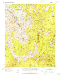
1983 Map of Bloody Mountain
USGS Topo · Published 1985About this map
Old Mammoth Mine and the Mammoth Consolidated Mine mark the high-elevation mining legacy of the Eastern Sierra on this 1980s survey. The landscape is defined by the convergence of the Inyo National Forest, Sierra National Forest, and the John Muir Wilderness, where a dense network of alpine water bodies including Sherwin Lakes, Lake Mary, and Duck Lake collect beneath the peaks. The remnants of Mill City (site) and the Monte Cristo Mine suggest an era of industrial extraction now superseded by recreation. Long-distance trekking is represented by the Pacific Crest Trail as it traverses the Mono and Fresno county lines, passing through meadows like Gentian Meadow and Sky Meadows. The terrain rises sharply to summits like Bloody Mountain and Laurel Mountain, overlooking the vast Long Valley to the northeast.
Find a feature on this map
58 named features on this map. Tap any name to fly to it.
Don’t see what you’re looking for? This feature index may not catch every label — zoom into the map to look around manually.
Map Details
Editions of this 1983 Bloody Mountain Map
2 editions found
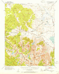
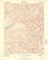
Other maps of this area

1901 · Mt. Lyell
USGS Topo · 1:125,000

1904 · Kaiser
USGS Topo · 1:125,000

1912 · Mt. Goddard
USGS Topo · 1:125,000

1914 · Mt. Morrison
USGS Topo · 1:125,000

1947 · Mariposa
USGS Topo · 1:250,000

1948 · Mariposa
USGS Topo · 1:250,000
1953 · Mt. Morrison
USGS Topo · 1:62,500
1953 · Mt Abbot
USGS Topo · 1:62,500
1953 · Devils Postpile
USGS Topo · 1:62,500
1953 · Kaiser Peak
USGS Topo · 1:62,500