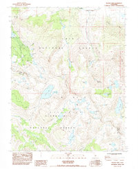
1983 Map of Bloody Mtn
USGS Topo · Published 1984About this map
Old Mammoth and the nearby Mill City (Site) represent a high-altitude industrial landscape shaped by mining and later tourism within the Inyo National Forest. The map details a concentration of early extraction sites, including the Old Mammoth Mine, Monte Cristo Mine, and Mammoth Consolidated Mine, situated near the distinctive Mammoth Rock. These operations were established in a complex alpine environment characterized by the steep Mammoth Crest and numerous glacial basins.
Find a feature on this map
60 named features on this map. Tap any name to fly to it.
Don’t see what you’re looking for? This feature index may not catch every label — zoom into the map to look around manually.
Map Details
Editions of this 1983 Bloody Mtn Map
2 editions found
Other maps of this area

1901 · Mt. Lyell
USGS Topo · 1:125,000

1904 · Kaiser
USGS Topo · 1:125,000

1912 · Mt. Goddard
USGS Topo · 1:125,000

1914 · Mt. Morrison
USGS Topo · 1:125,000

1947 · Mariposa
USGS Topo · 1:250,000

1948 · Mariposa
USGS Topo · 1:250,000

1953 · Mt. Morrison
USGS Topo · 1:62,500

1953 · Mt Abbot
USGS Topo · 1:62,500

1953 · Devils Postpile
USGS Topo · 1:62,500

1953 · Kaiser Peak
USGS Topo · 1:62,500