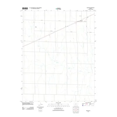
2012 Map of Bloom
USGS Topo · Published 2012About this map
The small community of Bloom anchors this Western Kansas landscape, situated along a primary transportation corridor that cuts diagonally across the northern section of the map. This 2012 survey illustrates the grid-like organization of Ford County's agricultural land, where names like Yucca Rd and Coline Rd define the boundaries between vast tracts of prairie and farmland. The local history of the settlement is reflected in the Bloom Cem, located just north of the town center, and the nearby Shelor Airport, which suggests the importance of light aviation in managing these expansive rural distances.
Find a feature on this map
16 named features on this map. Tap any name to fly to it.
Don’t see what you’re looking for? This feature index may not catch every label — zoom into the map to look around manually.
Map Details
Editions of this 2012 Bloom Map
This is the sole edition of this map. No revisions or reprints were ever made.
Other maps of this area

1892 · Meade
USGS Topo · 1:125,000

1892 · Dodge
USGS Topo · 1:125,000

1892 · Spearville
USGS Topo · 1:125,000

1894 · Spearville
USGS Topo · 1:125,000

1896 · Ashland
USGS Topo · 1:125,000

1955 · Pratt
USGS Topo · 1:250,000

1955 · Dodge City
USGS Topo · 1:250,000

1958 · Dodge City
USGS Topo · 1:250,000

1959 · Pratt
USGS Topo · 1:250,000

1959 · Dodge City
USGS Topo · 1:250,000