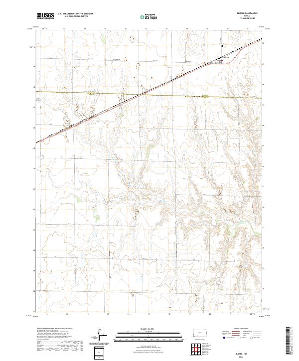
2022 Map of Bloom
USGS Topo · Published 2022About this map
The settlement of Bloom sits along the northern edge of this Kansas landscape, serving as a focal point for the surrounding agricultural network. Just north of the town center, the Bloom Cem provides a genealogical touchstone for the region's long-term residents. The terrain is defined by the winding course of Bluff Cr, which snakes through the central and southern portions of the map, carving a distinct drainage pattern into the prairie.
Find a feature on this map
38 named features on this map. Tap any name to fly to it.
Don’t see what you’re looking for? This feature index may not catch every label — zoom into the map to look around manually.
Map Details
Editions of this 2022 Bloom Map
This is the sole edition of this map. No revisions or reprints were ever made.
Other maps of this area

1892 · Meade
USGS Topo · 1:125,000

1892 · Dodge
USGS Topo · 1:125,000

1892 · Spearville
USGS Topo · 1:125,000

1894 · Spearville
USGS Topo · 1:125,000

1896 · Ashland
USGS Topo · 1:125,000

1955 · Pratt
USGS Topo · 1:250,000

1955 · Dodge City
USGS Topo · 1:250,000

1958 · Dodge City
USGS Topo · 1:250,000

1959 · Pratt
USGS Topo · 1:250,000

1959 · Dodge City
USGS Topo · 1:250,000