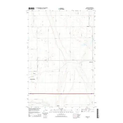
2014 Map of Bloom
USGS Topo · Published 2014About this map
Jamestown occupies the southwestern corner of this prairie landscape, where the eastern edges of the city meet the rural agricultural grid of Stutsman County. The terrain is defined by glacial features, notably the meandering James River and the deeply carved Sevenmile Coulee, which cuts through the southern sections. This area represents a critical corridor for regional infrastructure, as evidenced by the density of section-line roads and the proximity of small settlements like Bloom and Spiritwood. Local history is anchored by markers such as the Spiritwood Cem and industrial sites like the Frey Gravel Pit. To the north and east, the land opens into a pattern of potholes and wetlands, including Nine Lake and Rush Island Lake, reflecting the characteristic drift plain topography of central North Dakota.
Find a feature on this map
28 named features on this map. Tap any name to fly to it.
Don’t see what you’re looking for? This feature index may not catch every label — zoom into the map to look around manually.
Map Details
Editions of this 2014 Bloom Map
This is the sole edition of this map. No revisions or reprints were ever made.
Other maps of this area

1896 · Jamestown
USGS Topo · 1:125,000

1897 · Eckelson
USGS Topo · 1:125,000

1900 · Pingree
USGS Topo · 1:125,000

1950 · Fried
USGS Topo · 1:24,000

1951 · Jamestown
USGS Topo · 1:24,000

1951 · Fried
USGS Topo · 1:24,000

1951 · Spiritwood Lake
USGS Topo · 1:24,000

1952 · Homer
USGS Topo · 1:24,000

1952 · Ypsilanti
USGS Topo · 1:24,000

1952 · Bloom
USGS Topo · 1:24,000