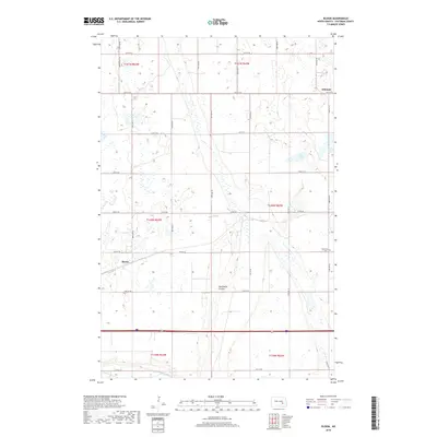
2018 Map of Bloom
USGS Topo · Published 2018About this map
The settlement of Bloom serves as a central anchor for this pocket of Stutsman County, where the topography is defined by the prairie potholes and drainage patterns of the northern Great Plains. In the southern reach of the quadrangle, the James River snakes through the landscape, joined by the distinctive Sevenmile Coulee. The rural grid is peppered with smaller bodies of water like Nine Lake and Rush Island Lake, which sit alongside the small settlement of Johnson near the eastern border.
Find a feature on this map
24 named features on this map. Tap any name to fly to it.
Don’t see what you’re looking for? This feature index may not catch every label — zoom into the map to look around manually.
Map Details
Editions of this 2018 Bloom Map
This is the sole edition of this map. No revisions or reprints were ever made.
Other maps of this area

1896 · Jamestown
USGS Topo · 1:125,000

1897 · Eckelson
USGS Topo · 1:125,000

1900 · Pingree
USGS Topo · 1:125,000

1950 · Fried
USGS Topo · 1:24,000

1951 · Jamestown
USGS Topo · 1:24,000

1951 · Fried
USGS Topo · 1:24,000

1951 · Spiritwood Lake
USGS Topo · 1:24,000

1952 · Homer
USGS Topo · 1:24,000

1952 · Ypsilanti
USGS Topo · 1:24,000

1952 · Bloom
USGS Topo · 1:24,000