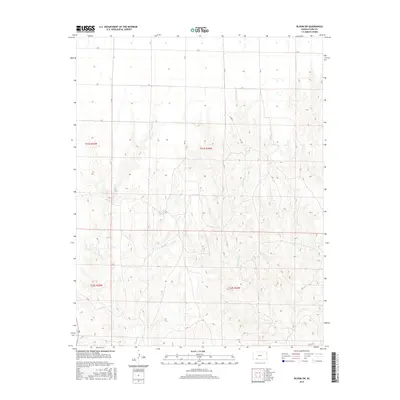
2016 Map of Bloom SW
USGS Topo · Published 2016About this map
Little Sandy Cr and Keiger Cr define the drainage patterns of this Clark County landscape, where the High Plains topography breaks into complex draws and drainage channels. This 2016 survey illustrates the persistent section-line road network typical of the Kansas prairie, featuring routes like Cr H, Cr I, and Cr J. The map provides a clear look at the rural land management within Township 31 South, Range 25 West and Township 31 South, Range 24 West, showing how modern county infrastructure like Co Rd 11 adapts to the natural contours of the stream valleys. This is a characteristic view of the western Kansas ranching and agricultural interior, where the relationship between the flat upland plateaus and the eroded creek beds dictates the placement of every road and boundary line.
Find a feature on this map
10 named features on this map. Tap any name to fly to it.
Don’t see what you’re looking for? This feature index may not catch every label — zoom into the map to look around manually.
Map Details
Editions of this 2016 Bloom SW Map
This is the sole edition of this map. No revisions or reprints were ever made.
Other maps of this area

1892 · Meade
USGS Topo · 1:125,000

1896 · Ashland
USGS Topo · 1:125,000

1955 · Pratt
USGS Topo · 1:250,000

1955 · Dodge City
USGS Topo · 1:250,000

1958 · Dodge City
USGS Topo · 1:250,000

1959 · Pratt
USGS Topo · 1:250,000

1959 · Dodge City
USGS Topo · 1:250,000

1967 · Bloom
USGS Topo · 1:24,000

1967 · Fowler SE
USGS Topo · 1:24,000

1967 · Minneola
USGS Topo · 1:24,000