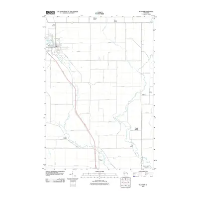
2010 Map of Bloomer
USGS Topo · Published 2010About this map
The Bloomer Mill Dam on the western edge of Bloomer anchors a landscape defined by the convergence of agricultural tradition and modern infrastructure. This 2010 survey records the intricate network of county highways and numbered avenues that partition the terrain between Duncan Creek and McCann Creek. The map provides significant genealogical value through its documentation of rural burial grounds, including Saint Catherine Cemetery to the north and the O'Neil Creek Cemetery near the crossroads of Eagle Point. Small settlements such as Eagleton and Tilden remain connected by the winding course of O'Neil Creek, while aviation interests are represented by the Bloomer Municipal Airport and the Chippewa County Senior Squadron Airport further south. The contrast between the rigid road grid and the meandering waterways illustrates the classic Upper Midwest balance between land management and the natural hydrology of the Lake Como drainage basin.
Find a feature on this map
50 named features on this map. Tap any name to fly to it.
Don’t see what you’re looking for? This feature index may not catch every label — zoom into the map to look around manually.
Map Details
Editions of this 2010 Bloomer Map
This is the sole edition of this map. No revisions or reprints were ever made.
Other maps of this area

1934 · Elk Mound
USGS Topo · 1:62,500

1934 · Chippewa Falls
USGS Topo · 1:62,500

1936 · Chippewa Falls
USGS Topo · 1:62,500

1936 · Elk Mound
USGS Topo · 1:62,500

1949 · Bloomer
USGS Topo · 1:62,500

1949 · New Auburn
USGS Topo · 1:62,500

1951 · Bloomer
USGS Topo · 1:62,500

1951 · New Auburn
USGS Topo · 1:62,500

1953 · Eau Claire
USGS Topo · 1:250,000

1953 · Rice Lake
USGS Topo · 1:250,000