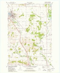
1975 Map of Bloomer
USGS Topo · Published 1978About this map
Bloomer serves as the focal point for this mid-1970s survey of northwestern Chippewa County, where the industrial presence of the C & NW railroad and the local Fairground anchor the community life near Lake Como. The landscape transitions from the developed streets of the city to the rural townships of Woodmohr and Tilden, defined by a network of creeks including Duncan Creek and O'Neil Creek. Genealogy researchers will find significant value in the numerous burial sites across the quadrangle, from the North St Paul Cem to the Scandinavian Ch and its associated cemetery. The presence of the Municipal Airport and various Gravel Pits reflects the area's mid-century economic infrastructure, while outlying settlements like Eagleton and Eagle Point maintain their distinct rural character along well-traveled routes like Eagleton Rd.
Find a feature on this map
46 named features on this map. Tap any name to fly to it.
Don’t see what you’re looking for? This feature index may not catch every label — zoom into the map to look around manually.
Map Details
Editions of this 1975 Bloomer Map
This is the sole edition of this map. No revisions or reprints were ever made.
Other maps of this area

1934 · Elk Mound
USGS Topo · 1:62,500

1934 · Chippewa Falls
USGS Topo · 1:62,500

1936 · Chippewa Falls
USGS Topo · 1:62,500

1936 · Elk Mound
USGS Topo · 1:62,500

1949 · Bloomer
USGS Topo · 1:62,500

1949 · New Auburn
USGS Topo · 1:62,500

1951 · Bloomer
USGS Topo · 1:62,500

1951 · New Auburn
USGS Topo · 1:62,500

1953 · Eau Claire
USGS Topo · 1:250,000

1953 · Rice Lake
USGS Topo · 1:250,000