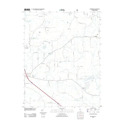
2012 Map of Bloomfield
USGS Topo · Published 2012About this map
Bloomfield and the surrounding southern Illinois uplands are defined by a network of rural roads and cemeteries that speak to generations of local settlement. The landscape is carved by numerous waterways, including Little Cache Cr and Max Cr, which feed into local landmarks like Vienna City Lake. Family names are deeply etched into the geography, visible in features such as McCorkle Cem, Ledbetter Cem, and Whiteside Cem. Small crossroads communities like Pond, Wartrace, and Simpson anchor the eastern and southern reaches of the map, while the River to River Trl provides a modern connection across this historically rich terrain. Infrastructure for both water management and local travel is evident, from the Little Cache Number 1 Reservoir to the private Covey Airport, illustrating how the community has adapted to the natural drainages of Johnson Cr and Mill Cr.
Find a feature on this map
70 named features on this map. Tap any name to fly to it.
Don’t see what you’re looking for? This feature index may not catch every label — zoom into the map to look around manually.
Map Details
Editions of this 2012 Bloomfield Map
This is the sole edition of this map. No revisions or reprints were ever made.
Other maps of this area

1917 · Brownfield
USGS Topo · 1:62,500

1918 · Vienna
USGS Topo · 1:62,500

1919 · Vienna
USGS Topo · 1:62,500

1925 · Marion
USGS Topo · 1:62,500

1925 · Harrisburg
USGS Topo · 1:62,500

1939 · Harrisburg
USGS Topo · 1:62,500

1940 · Marion
USGS Topo · 1:62,500

1942 · Vienna
USGS Topo · 1:62,500

1949 · Paducah
USGS Topo · 1:250,000

1950 · Paducah
USGS Topo · 1:250,000