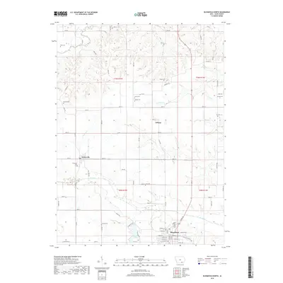
2018 Map of Bloomfield North
USGS Topo · Published 2018About this map
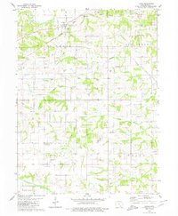
Drakesville and Belknap anchor the rural landscape north of the county seat in Davis County, where the southern Iowa terrain is defined by the meandering courses of the Fox River and Chequest Cr. The area is notably dense with small family and community burial grounds, providing a significant map for genealogical research. Locations like the Odd Fellows Cem near the northern edge of Bloomfield and the Breeding Cem to the west reflect generations of settlement along the section lines. The topography transitions from the alluvial bottomlands of Soap Creek in the north to the more structured grid of gravel roads and trails that connect remote farmsteads. Significant water features like Lake Fisher suggest the development of local water resources and recreation, while the intricate network of named roads like Kiwi Blvd and Mink Blvd illustrates the modern organization of this agricultural heartland.
Find a feature on this map
82 named features on this map. Tap any name to fly to it.
Don’t see what you’re looking for? This feature index may not catch every label — zoom into the map to look around manually.
Map Details
Editions of this 2018 Bloomfield North Map
This is the sole edition of this map. No revisions or reprints were ever made.
Other maps of this area

1954 · Centerville
USGS Topo · 1:250,000

1956 · Agency
USGS Topo · 1:24,000

1956 · Ottumwa South
USGS Topo · 1:24,000

1956 · Ottumwa South
USGS Topo · 1:62,500

1957 · Centerville
USGS Topo · 1:250,000

1958 · Centerville
USGS Topo · 1:250,000
1968 · Blakesburg NE
USGS Topo · 1:24,000
1968 · Paris
USGS Topo · 1:24,000
1979 · West Grove
USGS Topo · 1:24,000
1979 · Floris
USGS Topo · 1:24,000