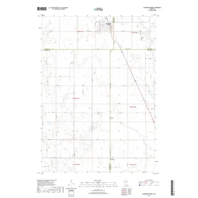
2019 Map of Blooming Prairie
USGS Topo · Published 2019About this map
Blooming Prairie sits at a geographic crossroads where Steele, Dodge, Freeborn, and Mower counties converge. This 2019 survey illustrates the organized grid of the southern Minnesota agricultural landscape, defined by a network of rural roads such as Co Hwy 15 and Co Rd 103. The area is shaped by its drainage systems, featuring the Cedar River in the east and the meandering Deer Cr and Magnuson Ditch to the west. Small community centers and places of local heritage are preserved in the mapping of Corning and several rural burial grounds. Genealogists and local historians will find the locations of the Red Oak Grove Cem, Udolpho Cem, and First Lutheran Cem essential for tracing family roots in this prairie region.
Find a feature on this map
43 named features on this map. Tap any name to fly to it.
Don’t see what you’re looking for? This feature index may not catch every label — zoom into the map to look around manually.
Map Details
Editions of this 2019 Blooming Prairie Map
This is the sole edition of this map. No revisions or reprints were ever made.
Other maps of this area

1954 · Hayward
USGS Topo · 1:62,500

1954 · Austin
USGS Topo · 1:62,500

1954 · Mason City
USGS Topo · 1:250,000

1957 · Mason City
USGS Topo · 1:250,000

1958 · Mason City
USGS Topo · 1:250,000

1966 · Waltham
USGS Topo · 1:24,000

1966 · Hayfield NW
USGS Topo · 1:24,000

1967 · Steele Center
USGS Topo · 1:24,000

1967 · Bixby
USGS Topo · 1:24,000

1967 · Blooming Prairie
USGS Topo · 1:24,000