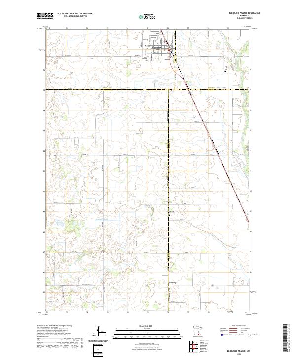
2022 Map of Blooming Prairie
USGS Topo · Published 2022About this map
Blooming Prairie sits at the intersection of several county boundaries, serving as a hub for the surrounding agricultural landscape of Steele and Dodge counties. This modern topographic study shows the town's grid and its proximity to historical burial sites like First Lutheran Cem, while further south, the settlement of Corning marks the boundary near the Freeborn and Mower County line. The terrain is defined by its water management and drainage systems, featuring the prominent Magnuson Ditch and the meandering course of Deer Cr. To the east, the Cedar River flows through the landscape, a perennial landmark in this region of Southern Minnesota. For local historians and genealogists, the map provides precise locations for outlying landmarks such as the Red Oak Grove Cem and Udolpho Cem, documenting their placement within the section-line road network.
Find a feature on this map
40 named features on this map. Tap any name to fly to it.
Don’t see what you’re looking for? This feature index may not catch every label — zoom into the map to look around manually.
Map Details
Editions of this 2022 Blooming Prairie Map
This is the sole edition of this map. No revisions or reprints were ever made.
Other maps of this area

1954 · Hayward
USGS Topo · 1:62,500

1954 · Austin
USGS Topo · 1:62,500

1954 · Mason City
USGS Topo · 1:250,000

1957 · Mason City
USGS Topo · 1:250,000

1958 · Mason City
USGS Topo · 1:250,000

1966 · Waltham
USGS Topo · 1:24,000

1966 · Hayfield NW
USGS Topo · 1:24,000

1967 · Steele Center
USGS Topo · 1:24,000

1967 · Bixby
USGS Topo · 1:24,000

1967 · Blooming Prairie
USGS Topo · 1:24,000