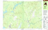
1999 Map of Bloomingdale
USGS Topo · Published 2001About this map
Bloomingdale and Vermontville serve as primary centers of settlement in this 1999 photoinspection of the northern Adirondacks. The map highlights a landscape defined by its glacial heritage, where the Saranac River winds through a terrain of numerous water bodies like Rainbow Lake, Osgood Pond, and Loon Lake. The regional aviation infrastructure is prominent at the Adirondack Airport, while educational history is represented by the campus of Paul Smiths College near Paul Smiths Easy Street.
Find a feature on this map
55 named features on this map. Tap any name to fly to it.
Don’t see what you’re looking for? This feature index may not catch every label — zoom into the map to look around manually.
Map Details
Editions of this 1999 Bloomingdale Map
This is the sole edition of this map. No revisions or reprints were ever made.
Other maps of this area

1896 · Lake Placid
USGS Topo · 1:62,500

1898 · Lake Placid
USGS Topo · 1:62,500

1902 · Saranac
USGS Topo · 1:62,500

1904 · Saranac
USGS Topo · 1:62,500

1905 · Saint Regis
USGS Topo · 1:62,500

1906 · Loon Lake
USGS Topo · 1:62,500

1908 · Loon Lake
USGS Topo · 1:62,500

1911 · Lyon Mountain
USGS Topo · 1:62,500

1913 · Lyon Mountain
USGS Topo · 1:62,500

1921 · Santa Clara
USGS Topo · 1:62,500