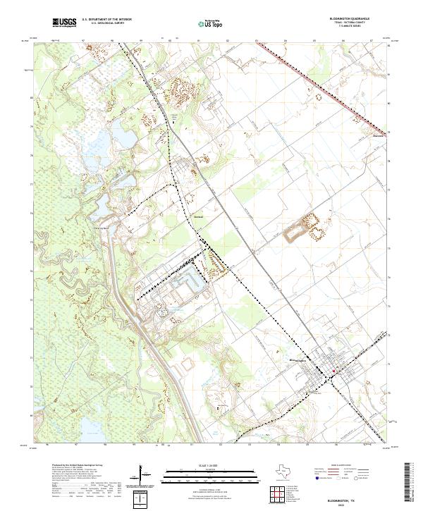
2022 Map of Bloomington
USGS Topo · Published 2022About this map
The Guadalupe River meanders through this coastal prairie landscape, defining a complex system of wetlands and waterways including Pickering Basin and Lipscomb and Son Reservoir. The settlement of Bloomington serves as the primary hub in the southeastern quadrant, featuring a concentrated street grid that includes the Bloomington Community Cem. Heavy industrial influence is evident centrally at the Dupont Cooling Basin, which dominates the local hydrologic footprint near Dernal. Smaller settlements like Dacosta appear in the northeast, connected by a network of farm-to-market roads and local lanes such as Black Bayou Rd and Diebel Dr. For genealogists and local historians, several burial sites are documented across the quadrangle, including San Jose Cem and Crescent Valley Cem, often situated near older rural roads and drainage features like Black Bayou and Old River.
Find a feature on this map
81 named features on this map. Tap any name to fly to it.
Don’t see what you’re looking for? This feature index may not catch every label — zoom into the map to look around manually.
Map Details
Editions of this 2022 Bloomington Map
This is the sole edition of this map. No revisions or reprints were ever made.
Other maps of this area

1951 · Bloomington
USGS Topo · 1:24,000

1952 · Bloomington SW
USGS Topo · 1:24,000

1952 · Marcado Creek
USGS Topo · 1:24,000

1952 · Placedo
USGS Topo · 1:24,000

1952 · Victoria East
USGS Topo · 1:24,000

1952 · Green Lake
USGS Topo · 1:24,000

1953 · Beeville
USGS Topo · 1:250,000

1956 · Beeville
USGS Topo · 1:250,000

1960 · Beeville
USGS Topo · 1:250,000

1962 · McFaddin
USGS Topo · 1:24,000