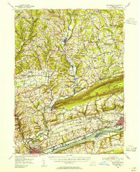
1954 Map of Bloomsburg
USGS Topo · Published 1955About this map
Fishing Creek and its many tributaries carve through the central landscape of this Columbia County mid-century survey, creating a network of narrow valleys and high ridges like Bunker Hill and Knob Mountain. The riverfront along the Susquehanna River is the primary corridor for industry and transportation, anchored by the town of Berwick and the campus of the State Teachers College in Bloomsburg. The local economy and leisure are evidenced by features like the Army Test Track near the river and the Drive-in Theater west of town.
Find a feature on this map
140 named features on this map. Tap any name to fly to it.
Don’t see what you’re looking for? This feature index may not catch every label — zoom into the map to look around manually.
Map Details
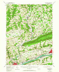
Editions of this 1954 Bloomsburg Map
2 editions found
Other maps of this area

1889 · Catawissa
USGS Topo · 1:62,500

1891 · Harveys Lake
USGS Topo · 1:62,500

1892 · Catawissa
USGS Topo · 1:62,500

1892 · Shamokin
USGS Topo · 1:62,500

1892 · Mahanoy
USGS Topo · 1:62,500

1893 · Harvey Lake
USGS Topo · 1:62,500

1893 · Shamokin
USGS Topo · 1:62,500

1893 · Mahanoy
USGS Topo · 1:62,500

1894 · Catawissa
USGS Topo · 1:62,500

1894 · Shickshinny
USGS Topo · 1:62,500