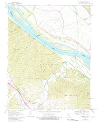
1970 Map of Bloomsdale
USGS Topo · Published 1982About this map
The Mississippi River serves as the central artery on this survey, carving a path between Illinois and Missouri and defining the boundaries of Monroe, Randolph, and Ste. Genevieve counties. The riparian landscape is characterized by a series of large river islands, including Beagles Island, Fort Chartres Island, and Schmidts Island, protected by an extensive Levee system. On the Illinois side, Fort Chartres State Park preserves the colonial footprint near the settlement of Kidd, while the Missouri shore rises into a complex network of timbered ridges and hollows.
Find a feature on this map
38 named features on this map. Tap any name to fly to it.
Don’t see what you’re looking for? This feature index may not catch every label — zoom into the map to look around manually.
Map Details
Editions of this 1970 Bloomsdale Map
3 editions found
Other maps of this area

1904 · Farmington
USGS Topo · 1:62,500

1906 · Farmington
USGS Topo · 1:62,500

1907 · Weingarten
USGS Topo · 1:62,500

1909 · Weingarten
USGS Topo · 1:62,500

1915 · Renault
USGS Topo · 1:62,500

1915 · Crystal City
USGS Topo · 1:62,500

1940 · Renault
USGS Topo · 1:62,500

1949 · Saint Louis
USGS Topo · 1:250,000

1949 · Rolla
USGS Topo · 1:250,000

1949 · Crystal City
USGS Topo · 1:62,500