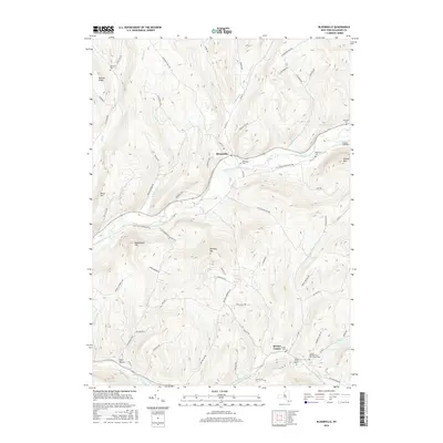
2016 Map of Bloomville
USGS Topo · Published 2016About this map
Bloomville and the winding course of the West Branch Delaware River anchor this topographic view of the Catskill region. The landscape is defined by its high ridges and the narrow valleys of its tributaries, including Wright Brook and Kidd Brook. To the south, the settlement of Bovina Center sits along the Little Delaware River, where the valley floors accommodate more concentrated development. The map is particularly rich in genealogical sites, featuring several burial grounds such as Riverside Cem and the United Presbyterian Old Church Cem. The terrain rises sharply to peaks like Bramley Mtn and Bovina Mtn, while the rural road network, including the Delhi-South Kortright Rd, follows the contours of the hills, connecting isolated hamlets like Glen Burnie to the larger river valleys.
Find a feature on this map
75 named features on this map. Tap any name to fly to it.
Don’t see what you’re looking for? This feature index may not catch every label — zoom into the map to look around manually.
Map Details
Editions of this 2016 Bloomville Map
This is the sole edition of this map. No revisions or reprints were ever made.
Other maps of this area

1901 · Margaretville
USGS Topo · 1:62,500

1904 · Hobart
USGS Topo · 1:62,500

1904 · Margaretville
USGS Topo · 1:62,500

1909 · Delhi
USGS Topo · 1:62,500

1911 · Delhi
USGS Topo · 1:62,500

1922 · Andes
USGS Topo · 1:62,500

1924 · Andes
USGS Topo · 1:62,500

1943 · Delhi
USGS Topo · 1:24,000

1943 · Bloomville
USGS Topo · 1:24,000
1943 · West Davenport
USGS Topo · 1:24,000