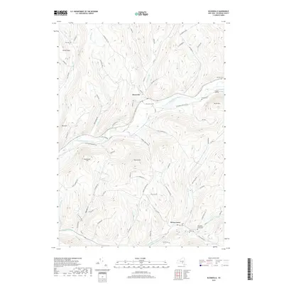
2019 Map of Bloomville
USGS Topo · Published 2019About this map
Bloomville and Bovina Center anchor this portion of the Catskill region, where the West Branch Delaware River and the Little Delaware River carve through high terrain. The landscape is defined by its deep narrow valleys and prominent summits like Bramley Mtn and Bovina Mtn. For those tracing local families, the map is particularly rich in burial grounds, featuring the Old United Presbyterian Church Cem alongside the Riverside Cem, Wetmore Cem, and Sackrider Cem. The network of roads, including Delhi-South Kortright Rd and Gregory Hill Rd, follows the natural contours of the hills and creeks, reflecting a long history of dairy farming and rural life in Delaware County. Small settlements like Grace's Landing sit nestled in the river bends, connected by a web of brook-side routes such as Kiff Brook Rd and Elk Creek Rd.
Find a feature on this map
76 named features on this map. Tap any name to fly to it.
Don’t see what you’re looking for? This feature index may not catch every label — zoom into the map to look around manually.
Map Details
Editions of this 2019 Bloomville Map
This is the sole edition of this map. No revisions or reprints were ever made.
Other maps of this area

1901 · Margaretville
USGS Topo · 1:62,500

1904 · Hobart
USGS Topo · 1:62,500

1904 · Margaretville
USGS Topo · 1:62,500

1909 · Delhi
USGS Topo · 1:62,500

1911 · Delhi
USGS Topo · 1:62,500

1922 · Andes
USGS Topo · 1:62,500

1924 · Andes
USGS Topo · 1:62,500

1943 · Delhi
USGS Topo · 1:24,000

1943 · Bloomville
USGS Topo · 1:24,000
1943 · West Davenport
USGS Topo · 1:24,000