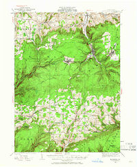
1925 Map of Blossburg
USGS Topo · Published 1966About this map
The Tioga River cuts through the deep valleys of northern Pennsylvania, anchoring a landscape defined by the mining and timber hubs of Blossburg and Arnot. Surveyed in the mid-1920s, this area shows the industrial footprint of the Erie R R, which connects narrow valley floor settlements like Morris Run and Landrus to the broader geography of Tioga County. The map captures a moment when the upland plateaus were still punctuated by fire protection and rural education, evidenced by the Maple Hill Fire Tower and a dense network of one-room schoolhouses such as Culver School and Baily School.
Find a feature on this map
65 named features on this map. Tap any name to fly to it.
Don’t see what you’re looking for? This feature index may not catch every label — zoom into the map to look around manually.
Map Details
Editions of this 1925 Blossburg Map
2 editions found
Other maps of this area

1900 · Tioga
USGS Topo · 1:62,500

1900 · Elkland
USGS Topo · 1:62,500

1902 · Tioga
USGS Topo · 1:62,500

1921 · Trout Run
USGS Topo · 1:62,500

1923 · Trout Run
USGS Topo · 1:62,500

1925 · Blossburg
USGS Topo · 1:62,500

1927 · Blossburg
USGS Topo · 1:62,500

1930 · Warrensville
USGS Topo · 1:62,500

1931 · Troy
USGS Topo · 1:48,000

1934 · Warrensville
USGS Topo · 1:62,500