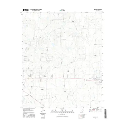
2016 Map of Blossom
USGS Topo · Published 2016About this map
Paris and its surrounding Lamar County prairie land are captured here during a period of steady residential expansion and agricultural activity. The landscape is defined by a dense network of creeks, including Sixmile Creek, Sevenmile Creek, and Ninemile Creek, which flow through the north while Mulberry Creek and Bee Bayou drain the southern reaches. The map highlights the eastern growth of the city toward Reno, centered around the Union Grove Cemetery and the industrial and aviation hub at Cox Field. To the east, the established town of Blossom sits along the rail corridor, while smaller communities like Sylvan and Faught remain as points of local history. Notable landmarks for genealogists and researchers include several rural burial grounds such as Sikes Cemetery and Corn Cemetery, alongside topographical features like Hogans Bluff.
Find a feature on this map
100 named features on this map. Tap any name to fly to it.
Don’t see what you’re looking for? This feature index may not catch every label — zoom into the map to look around manually.
Map Details
Editions of this 2016 Blossom Map
This is the sole edition of this map. No revisions or reprints were ever made.
Other maps of this area

1903 · Paris
USGS Topo · 1:125,000

1948 · Grant
USGS Topo · 1:62,500

1948 · Paris
USGS Topo · 1:62,500

1949 · Grant
USGS Topo · 1:62,500

1949 · Paris
USGS Topo · 1:62,500

1951 · Slate Shoals
USGS Topo · 1:24,000

1951 · Woodland
USGS Topo · 1:24,000

1953 · Texarkana
USGS Topo · 1:250,000

1956 · Texarkana
USGS Topo · 1:250,000

1964 · Detroit
USGS Topo · 1:24,000