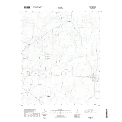
2019 Map of Blossom
USGS Topo · Published 2019About this map
Blossom and the northeastern outskirts of Paris anchor this landscape in Lamar County, characterized by a dense network of country roads and creek drainage systems. The settlement of Reno and the neighborhood of Sun Valley sit along the central transit corridor, while the expansive Cox Field reflects the area's aviation infrastructure south of the main highway. For those tracing family histories, the map identifies several local burial sites including Union Grove Cemetery, Moore Springs Cemetery, and Sikes Cemetery, alongside the small communities of Faught and Sylvan. The terrain is defined by the winding paths of Mulberry Creek and Sevenmile Creek, which flow through a mix of open land and developed spaces like Meadowbrook Memorial Park.
Find a feature on this map
73 named features on this map. Tap any name to fly to it.
Don’t see what you’re looking for? This feature index may not catch every label — zoom into the map to look around manually.
Map Details
Editions of this 2019 Blossom Map
This is the sole edition of this map. No revisions or reprints were ever made.
Other maps of this area

1903 · Paris
USGS Topo · 1:125,000

1948 · Grant
USGS Topo · 1:62,500

1948 · Paris
USGS Topo · 1:62,500

1949 · Grant
USGS Topo · 1:62,500

1949 · Paris
USGS Topo · 1:62,500

1951 · Slate Shoals
USGS Topo · 1:24,000

1951 · Woodland
USGS Topo · 1:24,000

1953 · Texarkana
USGS Topo · 1:250,000

1956 · Texarkana
USGS Topo · 1:250,000

1964 · Detroit
USGS Topo · 1:24,000