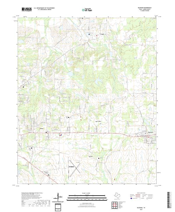
2022 Map of Blossom
USGS Topo · Published 2022About this map
Blossom and Reno anchor this rural Texas landscape, where modern aviation at Cox Field meets the deep-rooted settlement patterns of Lamar County. The terrain is defined by a dense network of county roads and farm-to-market routes like FM 196 and FM 195, which navigate the drainages of Sixmile Cr, Sevenmile Cr, and Ninemile Cr. These numeric creeks reflect a historical surveying method common in the region, marking distances from a central point.
Find a feature on this map
100 named features on this map. Tap any name to fly to it.
Don’t see what you’re looking for? This feature index may not catch every label — zoom into the map to look around manually.
Map Details
Editions of this 2022 Blossom Map
This is the sole edition of this map. No revisions or reprints were ever made.
Other maps of this area

1903 · Paris
USGS Topo · 1:125,000

1948 · Grant
USGS Topo · 1:62,500

1948 · Paris
USGS Topo · 1:62,500

1949 · Grant
USGS Topo · 1:62,500

1949 · Paris
USGS Topo · 1:62,500

1951 · Slate Shoals
USGS Topo · 1:24,000

1951 · Woodland
USGS Topo · 1:24,000

1953 · Texarkana
USGS Topo · 1:250,000

1956 · Texarkana
USGS Topo · 1:250,000

1964 · Detroit
USGS Topo · 1:24,000