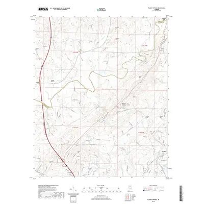
2018 Map of Blount Springs
USGS Topo · Published 2018About this map
Blount Springs and the surrounding terrain of the Sand Mountain region are defined by the winding course of the Mulberry Fork and a series of prominent ridges including Huffman Mtn, Duffy Mtn, and Hayden Mtn. This 2018 survey illustrates the complex topography of the Blount and Cullman County line, where the land drops into The Sink and rises toward gaps like Copperas Gap and Reid Gap. The map documents a mix of historic settlement patterns and modern infrastructure, from the early railroad influence seen at Blount Tunnel to the contemporary residential development at Smoke Rise.
Find a feature on this map
111 named features on this map. Tap any name to fly to it.
Don’t see what you’re looking for? This feature index may not catch every label — zoom into the map to look around manually.
Map Details
Editions of this 2018 Blount Springs Map
This is the sole edition of this map. No revisions or reprints were ever made.
Other maps of this area

1888 · Cullman
USGS Topo · 1:125,000

1889 · Birmingham
USGS Topo · 1:125,000

1892 · Cullman
USGS Topo · 1:125,000

1892 · Birmingham
USGS Topo · 1:125,000

1895 · Birmingham
USGS Topo · 1:125,000

1907 · Birmingham
USGS Topo · 1:125,000

1951 · Arkadelphia
USGS Topo · 1:24,000

1951 · Warrior
USGS Topo · 1:24,000
1951 · Creel
USGS Topo · 1:24,000

1951 · Blount Springs
USGS Topo · 1:24,000