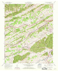
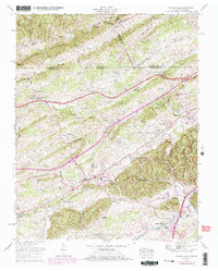
1959 Map of Blountville
USGS Topo · Published 1970About this map
Blountville serves as the focal point of this Sullivan County landscape, situated at a historic crossroads where the Daniel Boone Trail and the Lee Highway intersect. The map illustrates a period of significant transition as Interstate 81 appears under construction, cutting a diagonal path through the traditional farmsteads and ridges. To the southeast, the emergence of the Bristol International Speedway signifies a shift toward modern recreation alongside older landmarks like the Courthouse and Central Heights Sch.
Find a feature on this map
117 named features on this map. Tap any name to fly to it.
Don’t see what you’re looking for? This feature index may not catch every label — zoom into the map to look around manually.
Map Details
Editions of this 1959 Blountville Map
5 editions found
Other maps of this area

1891 · Roan Mountain
USGS Topo · 1:125,000

1894 · Roan Mountain
USGS Topo · 1:125,000

1897 · Bristol
USGS Topo · 1:125,000

1902 · Bristol
USGS Topo · 1:125,000

1904 · Roan Mountain
USGS Topo · 1:125,000

1934 · Wallace
USGS Topo · 1:24,000

1934 · Bristol
USGS Topo · 1:24,000

1935 · Hilton
USGS Topo · 1:24,000

1935 · Watauga Valley
USGS Topo · 1:48,000

1935 · Mendota
USGS Topo · 1:24,000