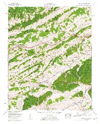
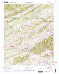
1959 Map of Blountville
USGS Topo · Published 1962About this map
The Blountville area in the late 1950s is defined by its deep ridge-and-valley topography and a dense network of family-named cemeteries and rural institutions. Significant landforms like Upper Cave Ridge and Middle Cave Ridge dominate the northwestern corner, while the Tennessee-Virginia state line cuts across the top of the sheet, dividing Sullivan Co from Scott and Washington counties. Small outlying communities like Beechnut City and Pullontown are connected by a winding network of roads, including the prominent Lee Highway.
Find a feature on this map
107 named features on this map. Tap any name to fly to it.
Don’t see what you’re looking for? This feature index may not catch every label — zoom into the map to look around manually.
Map Details
Editions of this 1959 Blountville Map
5 editions found
Other maps of this area

1891 · Roan Mountain
USGS Topo · 1:125,000

1894 · Roan Mountain
USGS Topo · 1:125,000

1897 · Bristol
USGS Topo · 1:125,000

1902 · Bristol
USGS Topo · 1:125,000

1904 · Roan Mountain
USGS Topo · 1:125,000

1934 · Wallace
USGS Topo · 1:24,000

1934 · Bristol
USGS Topo · 1:24,000

1935 · Hilton
USGS Topo · 1:24,000

1935 · Watauga Valley
USGS Topo · 1:48,000

1935 · Mendota
USGS Topo · 1:24,000