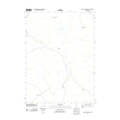
2011 Map of Blowout Mountain
USGS Topo · Published 2011About this map
Badger Cabin sits at the heart of this high-desert landscape in northwestern Nevada, serving as a primary human landmark in an area defined by its seasonal water sources and livestock grazing history. The drainage of Badger Creek provides a natural corridor through the terrain, connecting the high elevations of Fish Creek Mountain and Blowout Mountain to the expansive Badger Flat and Rodero Flat. These alluvial basins and reliable water points like Cottonwood Spring and Crystal Spring underscore the importance of water management in this arid environment. The map captures the remote character of Washoe County, where names like the Badger Mountains reflect the long-standing ranching and land-use traditions of the Great Basin.
Find a feature on this map
11 named features on this map. Tap any name to fly to it.
Don’t see what you’re looking for? This feature index may not catch every label — zoom into the map to look around manually.
Map Details
Editions of this 2011 Blowout Mountain Map
This is the sole edition of this map. No revisions or reprints were ever made.
Other maps of this area

1889 · Long Valley
USGS Topo · 1:250,000

1954 · Vya
USGS Topo · 1:250,000

1958 · Vya
USGS Topo · 1:250,000

1962 · Vya
USGS Topo · 1:250,000

1965 · Rock Spring Table
USGS Topo · 1:62,500

1966 · Swan Lake
USGS Topo · 1:24,000

1966 · Badger Mtn NW
USGS Topo · 1:24,000

1966 · Big Spring Butte
USGS Topo · 1:62,500

1966 · Blowout Mtn
USGS Topo · 1:24,000

1966 · Nut Mountain
USGS Topo · 1:24,000