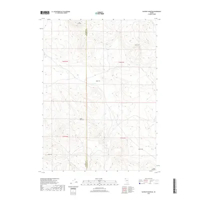
2018 Map of Blowout Mountain
USGS Topo · Published 2018About this map
Cottonwood Spring and Rodero Springs dot this high desert landscape, highlighting the critical importance of water sources in the arid borderlands of northwestern Nevada. This 2018 survey traces the line between Washoe and Humboldt counties as it passes through the Badger Mountains. The terrain is defined by high peaks and broad basins, including Fish Creek Mtn in the north and Badger Mtn in the southwest. Between these heights lie expansive areas like Badger Flat and Rodero Flat, where seasonal drainage from Badger Cr supports localized vegetation. The absence of developed roads or settlements emphasizes the remote character of this region, where geography is primarily defined by natural landmarks such as Smith Lake and the prominent Blowout Mtn.
Find a feature on this map
16 named features on this map. Tap any name to fly to it.
Don’t see what you’re looking for? This feature index may not catch every label — zoom into the map to look around manually.
Map Details
Editions of this 2018 Blowout Mountain Map
This is the sole edition of this map. No revisions or reprints were ever made.
Other maps of this area

1889 · Long Valley
USGS Topo · 1:250,000

1954 · Vya
USGS Topo · 1:250,000

1958 · Vya
USGS Topo · 1:250,000

1962 · Vya
USGS Topo · 1:250,000

1965 · Rock Spring Table
USGS Topo · 1:62,500

1966 · Swan Lake
USGS Topo · 1:24,000

1966 · Badger Mtn NW
USGS Topo · 1:24,000

1966 · Big Spring Butte
USGS Topo · 1:62,500

1966 · Blowout Mtn
USGS Topo · 1:24,000

1966 · Nut Mountain
USGS Topo · 1:24,000