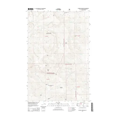
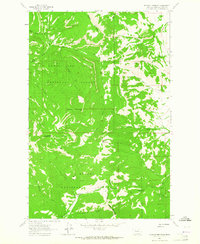
2014 Map of Blowout Mountain
USGS Topo · Published 2014About this map
Lewis and Clark Pass stands as a focal point in this high-elevation landscape, where the Continental Divide separates the headwaters of the Missouri and Columbia River systems. Located along the boundary of the Lewis & Clark National Forest and Helena National Forest, the terrain is defined by prominent peaks including Blowout Mtn, Red Mtn, and Sugarloaf Mtn. The hydrology of the region is equally complex, featuring the deep drainages of Alice Creek and the Alice Creek Basin in the south, while the northern slopes feed into Falls Creek and the Cuniff Basin. This survey illustrates the intricate network of gulches and ridges, such as Wildcat Gulch and Falls Creek Ridge, that historically dictated travel through the Lewis and Clark Range.
Find a feature on this map
45 named features on this map. Tap any name to fly to it.
Don’t see what you’re looking for? This feature index may not catch every label — zoom into the map to look around manually.
Map Details
Editions of this 2014 Blowout Mountain Map
This is the sole edition of this map. No revisions or reprints were ever made.
Other maps of this area

1903 · Coopers Lake
USGS Topo · 1:125,000

1943 · Hogan
USGS Topo · 1:125,000

1955 · Choteau
USGS Topo · 1:250,000

1957 · Choteau
USGS Topo · 1:250,000

1958 · Choteau
USGS Topo · 1:250,000

1962 · Choteau
USGS Topo · 1:250,000
1962 · Johnson Mountain
USGS Topo · 1:24,000
1963 · Rogers Pass
USGS Topo · 1:24,000
1963 · Cadotte Creek
USGS Topo · 1:24,000
1963 · Blowout Mountain
USGS Topo · 1:24,000