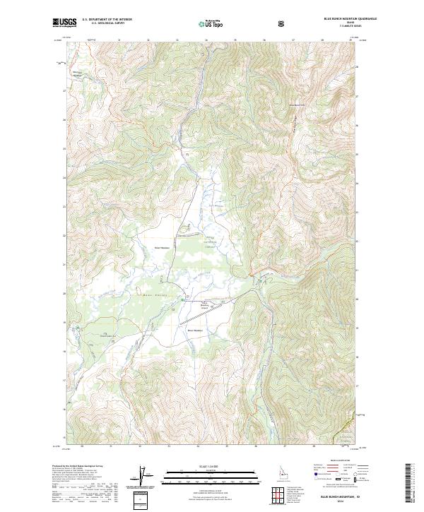
2024 Map of Blue Bunch Mountain
USGS Topo · Published 2024About this map
Bear Valley and its high-elevation meadowlands define this portion of the Idaho interior, where the Boise National Forest meets the Frank Church-River of No Return Wilderness. The map documents a landscape oriented around backcountry navigation and ranching heritage, specifically centered on Bear Valley Creek and its many tributaries like Dagger Creek and Ayers Creek. The presence of the Ayers Mdw Shipping Corral and the Bruce Meadows Airport highlights the area's continued use for land management and remote access.
Find a feature on this map
55 named features on this map. Tap any name to fly to it.
Don’t see what you’re looking for? This feature index may not catch every label — zoom into the map to look around manually.
Map Details
Editions of this 2024 Blue Bunch Mountain Map
This is the sole edition of this map. No revisions or reprints were ever made.
Other maps of this area

1891 · Bear Valley
USGS Topo · 1:125,000

1893 · Bear Valley
USGS Topo · 1:125,000

1957 · Challis
USGS Topo · 1:250,000

1960 · Challis
USGS Topo · 1:250,000

1961 · Greyhound Ridge
USGS Topo · 1:62,500

1961 · Chinook Mtn
USGS Topo · 1:62,500

1963 · Challis
USGS Topo · 1:250,000

1972 · Bull Trout Point
USGS Topo · 1:24,000
1972 · Banner Summit
USGS Topo · 1:24,000

1972 · Cache Creek
USGS Topo · 1:24,000