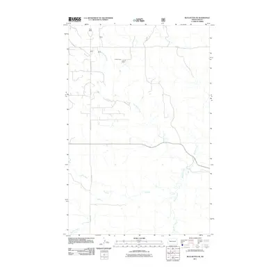
2011 Map of Blue Buttes SE
USGS Topo · Published 2011About this map
Aura Butte rises above the drainage networks of McKenzie County in this 2011 topographic survey. The landscape is defined by the convergence of several intermittent watercourses, including Handy Water Creek, Bear Den Creek, and Dry Creek, which carve through the plains. The presence of the C Mercer Ranch underscores the area's agricultural and ranching heritage, providing a specific point of interest for researchers of local land ownership and rural settlement patterns. Transportation through this part of the Four Bears Segment is facilitated by a network of rural roads such as Co Rte 14, BIA Rd 4, and County Rte 57. This map reflects the modern configuration of the North Dakota badlands and prairie, showing how the local road systems interact with the natural topography.
Find a feature on this map
10 named features on this map. Tap any name to fly to it.
Don’t see what you’re looking for? This feature index may not catch every label — zoom into the map to look around manually.
Map Details
Editions of this 2011 Blue Buttes SE Map
This is the sole edition of this map. No revisions or reprints were ever made.
Other maps of this area

1953 · Watford City
USGS Topo · 1:250,000

1957 · Watford City
USGS Topo · 1:250,000

1959 · Croff
USGS Topo · 1:24,000

1965 · Keene
USGS Topo · 1:24,000

1965 · Johnsons Corner
USGS Topo · 1:24,000

1965 · Blue Buttes
USGS Topo · 1:24,000

1965 · Blue Buttes SE
USGS Topo · 1:24,000

1967 · Watford City
USGS Topo · 1:250,000

1967 · Sanish NW
USGS Topo · 1:24,000

1967 · Sanish SW
USGS Topo · 1:24,000