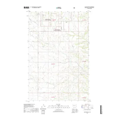
2020 Map of Blue Buttes SE
USGS Topo · Published 2020About this map
Little Missouri National Grassland encompasses a significant portion of this landscape, characterized by the prominent landforms of Blue Buttes and Aura Butte. These high points overlook a network of seasonal drainages, including Handy Water Cr, Bear Den Cr, and Dry Cr, which carve through the terrain of McKenzie County. The area is defined by its open expanse, with a geometric grid of rural roads and section lines providing the primary human structure against the natural topography.
Find a feature on this map
28 named features on this map. Tap any name to fly to it.
Don’t see what you’re looking for? This feature index may not catch every label — zoom into the map to look around manually.
Map Details
Editions of this 2020 Blue Buttes SE Map
This is the sole edition of this map. No revisions or reprints were ever made.
Other maps of this area

1953 · Watford City
USGS Topo · 1:250,000

1957 · Watford City
USGS Topo · 1:250,000

1959 · Croff
USGS Topo · 1:24,000

1965 · Keene
USGS Topo · 1:24,000

1965 · Johnsons Corner
USGS Topo · 1:24,000

1965 · Blue Buttes
USGS Topo · 1:24,000

1965 · Blue Buttes SE
USGS Topo · 1:24,000

1967 · Watford City
USGS Topo · 1:250,000

1967 · Sanish NW
USGS Topo · 1:24,000

1967 · Sanish SW
USGS Topo · 1:24,000