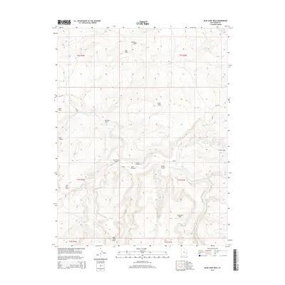
2014 Map of Blue Chief Mesa
USGS Topo · Published 2014About this map
The Dolores River carves a deep, serpentine path through the canyonlands of Grand County in this 2014 survey. The topography is defined by massive, flat-topped landforms such as Blue Chief Mesa, Sevenmile Mesa, and Buckhorn Mesa, which tower over the river's floodplains. Low-lying areas like Utah Bottoms provide a stark contrast to the surrounding heights of Hotel Mesa and Big Pinto Mesa. This terrain is a labyrinth of erosion, where named features like Line Canyon, Cottonwood Canyon, and Bridge Canyon drain into the main river corridor. The map tracks several primitive routes including Shura and Triangle, which negotiate the steep elevation changes between the river basin and the high desert plateaus. Notable geological points of interest, such as The Slide, indicate the active erosional forces shaping the landscape near Buckhorn Draw.
Find a feature on this map
27 named features on this map. Tap any name to fly to it.
Don’t see what you’re looking for? This feature index may not catch every label — zoom into the map to look around manually.
Map Details
Editions of this 2014 Blue Chief Mesa Map
This is the sole edition of this map. No revisions or reprints were ever made.
Other maps of this area

1885 · La Sal
USGS Topo · 1:250,000

1954 · Mt. Waas 4 NE
USGS Topo · 1:24,000

1954 · Mt. Waas 4 NW
USGS Topo · 1:24,000

1954 · Mt. Waas 3 NE
USGS Topo · 1:24,000

1954 · Mt. Waas 1 SW
USGS Topo · 1:24,000

1954 · Mt. Waas 1 NE
USGS Topo · 1:24,000

1954 · Mt. Waas 1 NW
USGS Topo · 1:24,000

1954 · Mt. Waas 1 SE
USGS Topo · 1:24,000

1954 · Coates Creek
USGS Topo · 1:62,500

1954 · Polar Mesa
USGS Topo · 1:62,500