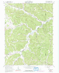
1961 Map of Blue Creek
USGS Topo · Published 1992About this map
Blue Creek serves as a central hub for the rugged township of Jefferson in Adams County, where the Township High School and St Josephs Ch anchored the local community in the early 1960s. The landscape is defined by the winding course of Brush Creek and its many tributaries, including Turkey Creek and Cedar Run, which carve through the Coleman Ridge and the Shawnee State Forest. The map captures a transition period for rural church life, documenting remote congregations such as White Oak Chapel, Moors Memorial Chapel, and Mt Unger Ch. For genealogists, the terrain reveals numerous family-named burial grounds like Drake Cem and Cassel Cem, as well as the small settlements of Wamsley and Jones Corner that dot the creek valleys.
Find a feature on this map
64 named features on this map. Tap any name to fly to it.
Don’t see what you’re looking for? This feature index may not catch every label — zoom into the map to look around manually.
Map Details
Editions of this 1961 Blue Creek Map
Other maps of this area

1915 · Garrison
USGS Topo · 1:62,500

1915 · Otway
USGS Topo · 1:62,500

1916 · Peebles
USGS Topo · 1:62,500

1917 · Otway
USGS Topo · 1:62,500

1918 · Garrison
USGS Topo · 1:62,500

1918 · Peebles
USGS Topo · 1:62,500

1919 · Vanceburg
USGS Topo · 1:62,500

1949 · Pond Run
USGS Topo · 1:24,000

1949 · Vanceburg
USGS Topo · 1:62,500

1949 · Buena Vista
USGS Topo · 1:24,000