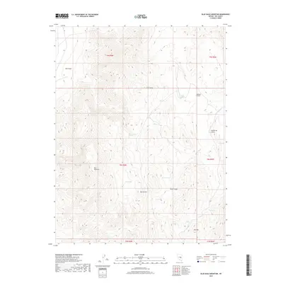
2018 Map of Blue Eagle Mountain
USGS Topo · Published 2018About this map
Blue Eagle Mtn stands as a prominent topographical anchor within the high-elevation landscape of Nye County, where the southern reaches of the Grant Range dominate the terrain. This 2018 survey documents a remote environment defined by its complex hydrology, featuring numerous named water sources that were historically vital to travelers and ranchers in this arid region. High-country springs such as Cazier Spring, Log Spring, and Andrew Spring are scattered across the slopes, marking the critical points of water availability between the steep walls of Box Canyon and Cold Spring Canyon. The map reveals a land utilized for its natural resources and surveyed into clear township and range sections. Prominent peaks including Bald Mtn and the topographic high of Tank Summit provide significant landmarks for navigation through the diverse canyons, including Beaty Canyon and Johnson Canyon, reflecting a landscape where geography dictates movement and survival.
Find a feature on this map
24 named features on this map. Tap any name to fly to it.
Don’t see what you’re looking for? This feature index may not catch every label — zoom into the map to look around manually.
Map Details
Editions of this 2018 Blue Eagle Mountain Map
This is the sole edition of this map. No revisions or reprints were ever made.
Other maps of this area

1956 · Lund
USGS Topo · 1:250,000

1960 · Lund
USGS Topo · 1:250,000

1964 · Blue Eagle Springs
USGS Topo · 1:62,500

1964 · Currant
USGS Topo · 1:62,500

1964 · Troy Canyon
USGS Topo · 1:62,500

1964 · Forest Home
USGS Topo · 1:62,500

1980 · Duckwater
USGS Topo · 1:100,000

1988 · Quinn Canyon Range
USGS Topo · 1:100,000
1990 · Wells Station
USGS Topo · 1:24,000
1990 · Currant
USGS Topo · 1:24,000