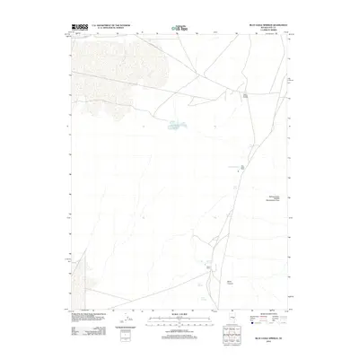
2012 Map of Blue Eagle Springs
USGS Topo · Published 2012About this map
Blue Eagle Ranch and Sharp Ranch stand as primary landmarks in this Nye County landscape, where water sources dictate the patterns of human settlement and industry. Numerous natural springs, including Blue Eagle Springs, Soda Spring, and Butterfield Springs, emerge at the desert's edge, supporting both local agriculture and the varied habitats within the Railroad Valley Wildlife Management Area. The importance of water is further marked by Duckwater Creek and the Blue Eagle Ponds, which offer a stark contrast to the surrounding arid terrain.
Find a feature on this map
16 named features on this map. Tap any name to fly to it.
Don’t see what you’re looking for? This feature index may not catch every label — zoom into the map to look around manually.
Map Details
Editions of this 2012 Blue Eagle Springs Map
This is the sole edition of this map. No revisions or reprints were ever made.
Other maps of this area

1956 · Lund
USGS Topo · 1:250,000

1960 · Lund
USGS Topo · 1:250,000

1964 · Blue Eagle Springs
USGS Topo · 1:62,500

1964 · Currant
USGS Topo · 1:62,500

1964 · Troy Canyon
USGS Topo · 1:62,500

1964 · Forest Home
USGS Topo · 1:62,500

1980 · Duckwater
USGS Topo · 1:100,000

1988 · Quinn Canyon Range
USGS Topo · 1:100,000
1990 · Currant
USGS Topo · 1:24,000
1990 · Meteorite Crater
USGS Topo · 1:24,000