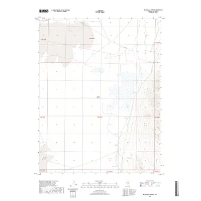
2018 Map of Blue Eagle Springs
USGS Topo · Published 2018About this map
Railroad Valley defines this section of Nye County, where a complex network of hydrologic features sustains life in the high desert. The map captures an intricate system of water sources, notably the eponymous Blue Eagle Springs and nearby Blue Eagle Ponds. These water features, alongside Butterfield Springs and the expansive Butterfield Marsh to the southwest, suggest a landscape where seasonal and permanent water dictates the topography and historical land use.
Find a feature on this map
23 named features on this map. Tap any name to fly to it.
Don’t see what you’re looking for? This feature index may not catch every label — zoom into the map to look around manually.
Map Details
Editions of this 2018 Blue Eagle Springs Map
This is the sole edition of this map. No revisions or reprints were ever made.
Other maps of this area

1956 · Lund
USGS Topo · 1:250,000

1960 · Lund
USGS Topo · 1:250,000

1964 · Blue Eagle Springs
USGS Topo · 1:62,500

1964 · Currant
USGS Topo · 1:62,500

1964 · Troy Canyon
USGS Topo · 1:62,500

1964 · Forest Home
USGS Topo · 1:62,500

1980 · Duckwater
USGS Topo · 1:100,000

1988 · Quinn Canyon Range
USGS Topo · 1:100,000
1990 · Currant
USGS Topo · 1:24,000
1990 · Meteorite Crater
USGS Topo · 1:24,000