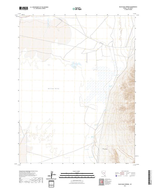
2021 Map of Blue Eagle Springs
USGS Topo · Published 2021About this map
Blue Eagle Springs emerges at the eastern edge of the expansive Railroad Valley basin, where a concentration of thermal and cold water sources supports a unique desert environment. This area of Nye County is defined by its transition from the flat basin floor to the rising elevations of the eastern mountains. Water remains the primary focal point of the landscape, with features such as Blue Eagle Ponds and Soda Spring dotting the base of the alluvial fans. The presence of Butterfield Springs, Cold Spring, and Bacon Springs suggests a historically significant watering network for travelers and livestock moving through this arid corridor. Transportation is represented by the isolated R R Valley Rd, while the topography to the south is cut by the dramatic lines of Beaty Canyon.
Find a feature on this map
18 named features on this map. Tap any name to fly to it.
Don’t see what you’re looking for? This feature index may not catch every label — zoom into the map to look around manually.
Map Details
Editions of this 2021 Blue Eagle Springs Map
This is the sole edition of this map. No revisions or reprints were ever made.
Other maps of this area

1956 · Lund
USGS Topo · 1:250,000

1960 · Lund
USGS Topo · 1:250,000

1964 · Blue Eagle Springs
USGS Topo · 1:62,500

1964 · Currant
USGS Topo · 1:62,500

1964 · Troy Canyon
USGS Topo · 1:62,500

1964 · Forest Home
USGS Topo · 1:62,500

1980 · Duckwater
USGS Topo · 1:100,000

1988 · Quinn Canyon Range
USGS Topo · 1:100,000
1990 · Currant
USGS Topo · 1:24,000
1990 · Meteorite Crater
USGS Topo · 1:24,000